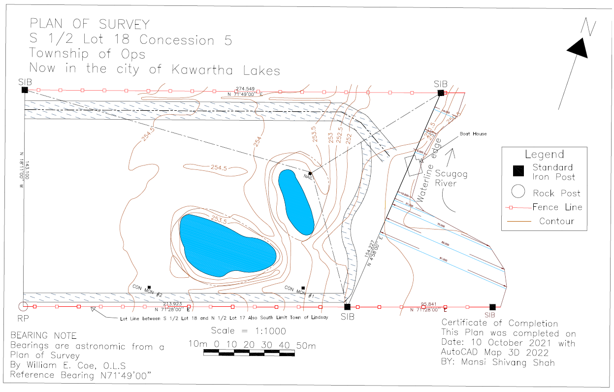
City of Kawartha Lakes Survey Plan
The survey plan of a plot near Scugog river in City of Kawartha Lakes was drawn in AutoCAD 2022 along with AutoCAD Map 3D launced in March 2021 that retains the location features in AutoCAD drawings was added by georeferencing the field note drawing and then finally digitizing the contour lines.
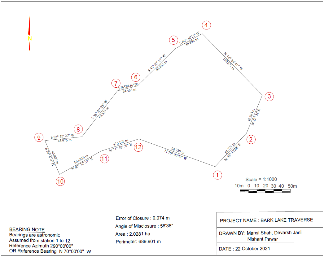
Survey Traverse Plan
The letter size traverse map was created from GIS survey camp field data using AutoCAD and Coordinate Geometry (COGO) tool. COGO is a method for calculating coordinate points from surveyed bearings and distances. Before starting, traverse calculations were done by using bearing calculation formulas of surveying and error of closure was calculated to know the accuracy of the survey which came out to be 0.074 meter and angle of misclosure is 58' 38" (58 minutes 38 seconds).